Missouri River Omaha – Boating, Fishing & RiverFront Attractions
Omaha’s Missouri River offers boat ramps, wildlife, and flood-safe parks. Explore downtown’s RiverFront and learn the river’s local importance.
Jul 12, 2025162 Shares6.7K Views
🌊 About The Missouri River In Omaha
The Missouri Riveris the longest river in North America, stretching over 2,300 miles from Montana to its meeting point with the Mississippi River. In Omaha, it forms the city’s eastern border and plays an important role in both the region’s history and present-day recreation. The river has supported trade, transportation, and exploration for centuries. Today, it remains a natural landmark that attracts visitors and locals alike for outdoor activities and scenic views.
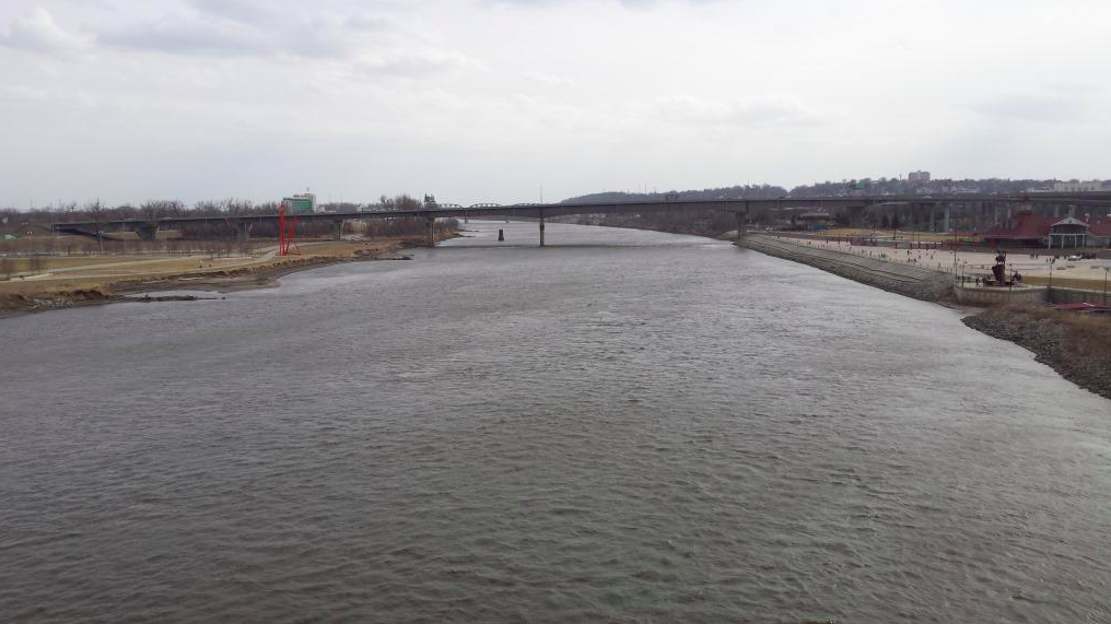
🏞️ The RiverFront – Omaha’s Revitalized Waterfront
Omaha has made major efforts to reconnect the city with the Missouri River through a large public space called The RiverFront. This modern riverfront development includes three main areas: Gene Leahy Mall, Lewis & Clark Landing, and Heartland of America Park. Together, they create nearly 72 acresof green space, walkways, art displays, a playground, performance zones, and a pier that extends over the river.
The RiverFront opened in phases between 2022 and 2023 and cost approximately $325 million, funded by a partnership between the City of Omaha and private donors. It’s designed for walking, relaxing, biking, and enjoying views of the Missouri River from downtown.
🚤 Boating Access & River Marinas
The Missouri River in Omaha is also used for boating and water activities. Several marinas and access points serve the area:
- NP Dodge Park Marinaoffers boat ramps, over 300 boat slips, parking, trailer storage, and restrooms. It’s one of the most popular boating spots in the Omaha area.
- Riverview Marina, located across the river near Council Bluffs, provides similar access for small boats, fishing, and docking.
These facilities are open during the boating season, which usually runs from spring through early fall.
🎣 Outdoor Activities & Wildlife Viewing
The river is part of the Missouri National Recreational River, a federally protected section that promotes outdoor activities. Fishing is a popular activity along the banks, and anglers can catch species like catfish, walleye, and bass. Nearby parks such as Elkhorn Crossing Recreation Areaand N.P. Dodge Parkoffer picnic areas, walking trails, and wildlife observation points.
Migratory birds and other native species can often be seen near the water, especially in the spring and fall months.
⚠️ Water Levels & Flood Management
The Missouri River has a long history of flooding in the Omaha area, with major events occurring in 1881, 1952, and 2011. These floods led to improved levee systems and better flood management. Today, the river is closely monitored by the U.S. Geological Survey (USGS)and National Weather Servicefor changes in water level and flow.
Flood control systems, including upstream dams like Gavins Point Dam, help regulate the river’s behavior and reduce the risk of damage to nearby neighborhoods and infrastructure.
✅ Why The Missouri River Is Important To Omaha
- It defines Omaha’s geographic and cultural border
- Supports outdoor recreationlike fishing, boating, and hiking
- Features scenic parks and public spaces through the RiverFront project
- Provides natural habitat for wildlife and bird migration
- Plays a key role in flood control and water management
Latest Articles
Popular Articles